Keynote Speakers
 |
Alfredo Ferreira
|
Virtual and Augmented Reality: from the Lab to the Wild
Virtual Reality (VR) is not a novelty. Virtual and Augmented Reality (VR/AR) has been explored in research labs for almost fifty years. From Sutherland and Sproull 1968 seminal work “Sword of Damocles”, whose name was inspired by the appearance of the device, to current wireless lightweight headsets and glasses, a long way has been walked. Today’s technology allows low-cost and (almost) easy-to-use VR/AR setups, bringing it from the lab to the real world.
While most common applications of VR/AR have been on entertainment, is widely accepted that a huge potential for this technology lies unexplored on several other domains. Architects, doctors, and engineers are already taking advantage of VR/AR in their workplaces. Ranging from walking into digital mock-ups, visualizing CAT scans and MRIs, or maintenance and assembly of mechanical parts, VR/AR applications have been exponentially growing in the last decade.
Control and monitoring systems, both local or remote” can greatly benefit from such VR/AR, now ready to be used “in the wild”. We believe that, by working together, computer scientists, engineering surveyors, and civil engineers, will identify and develop VR/AR tools to empower those working in real world context.
Alfredo Ferreira, Portugal
Assistant Professor in Computer Science and Engineering at IST/University of Lisbon.
Study at Technical University of Lisbon, where he received the BEng (2002), MSc (2005), and PhD (2009) degrees in Information Systems and Computer Science.
Lectures in Human Computer Interaction, Computer Graphics, 3D Object Processing, and Three-dimensional Animation and Visualization.
Research in Natural User Interfaces, Virtual and Augmented Reality, Immersive Multi-sensory Environments and 3D Shape Analysis.
Member of Scientific Board of the INESC-ID Lisboa, the European Association for Computer Graphics, the Association for Computing Machinery, and the Institute of Electrical and Electronics Engineers.
 |
Alojz Kopáčik
|
The potential of classical surveying methods for health care monitoring of large structures
Description of the dynamic behaviour of large structures give the main information about their condition. This idea is used in methodology which is known as structural health monitoring (SHM). Nowadays the ambient vibrations are mostly used for this purposes, measured by accelerometers. Thanks the rapid development in the field of classical surveying instrumentation (total stations, levels, etc.) last years, these could be used for this kind of measurements. Cooperation between civil engineers and experts in this field is necessary and bring many positive impulses to research and new development.
The usage of classical surveying technics generate often non-regular time series. Requirements, limitations and experiences achieved during development of different measurement systems will be presented and discussed. Examples will be presented, were the appropriate methodology of data processing generate correct results. Dynamic response of different structures measured by classical methods and accelerometers will be compared and analysed.
Alojz Kopáčik, Slovakia
Professor in Geodesy and Cartography at STU in Bratislava, Department of Surveying.
Study at STU in Bratislava, diploma from Geodesy and cartography (1982), PhD at STU in Bratislava, Faculty of Civil Engineering in the field optimization of geodetic networks (1987), habilitation in the field of navigation and inertial measurement systems (1998).
Lectures in Engineering surveying, Surveying for civil engineers, Underground and mine surveying,Industry surveying, Legislation in geodesy, Measuring systems in engineering surveying. Guest lectures at NIIGAIK Novosibirsk (Russia), BME Budapest, HAS Sopron (Hungary), University of Zagreb (Croatia), Polytechnik Warsaw (Poland), TU Vienna (Austria), etc.
Research in engineering surveying, automated measurement systems for deformation measurement, terrestrial laser scanning, radar interferometry, indoor navigation.
Member of Scientific Board of the Faculty of Civil Engineering in Bratislava, Žilina, Brno and Prague, German geodetic commission, FIG C6 Engineering surveying, FIG C2 Education, TC89 Geodesy and cartography, Chamber of surveyors and cartographers, editorial boards of journals Geodetski list (Croatia), Slovak Journal of Civil Engineering (Slovakia), Geonauka (Serbia).
 |
Ana Quintela |
The role of monitoring in Geotechnical works
Geotechnical works, their study, design and monitoring have to deal with a large amount of uncertainty, mainly due to the characteristics and heterogeneity of their foundations and, in the case of fill works, of the embankment materials. Several phenomena are involved and can condition the security of these works, such as mechanical resistance and deformation, seepage, collapse, etc.
Monitoring of natural and excavation slopes, constructions and their foundations is of crucial importance to deal with this uncertainty and to monitor their behaviour and detect eventual signs of misbehaviour. The identification and interpretation of these signs allows the anticipation of possible interventions and, consequently to minimize de damages, optimize costs and reduce risks of the involved populations.
The presentation aims to highlight the importance of surveying and monitoring of geotechnical works, by showing different kinds of structures, linking to the phenomena normally involved in each kind of these structures and the related monitored magnitudes.
Special attention will be given to displacement measurements, as far as superficial and internal displacements of geotechnical works are of crucial importance in monitoring their security.
Ana Quintela, Portugal
Senior Engineer in TETRAPALNO, member of COBA Group Consultants; Head of Geotechnics Department.
Study at the Engineering School (IST) of the Lisbon University, Portugal, diploma of Civil Engineering (1987) and MSc in Soil Mechanics from the Faculty of Sciences and Technology – FCT NOVA (19918).
Lectures as Invited Professor at the FCT NOVA in the field of soil Mechanics, Geotechnical Structures and Embankment.
Activity and Research in the field of geotechnical works since the beginning of the professional activity in the National Laboratory of Civil Engineering (Lisbon, 1985) and, after 1992, in Civil Engineering Consultancy Companies. The activity has been centred in feasibility studies, design projects and monitoring of Geotechnical Works, namely embankment dams, slope stability, in engineering surveying, automated measurement systems for deformation measurement, terrestrial laser scanning, radar interferometry, indoor navigation.
Member of Portuguese Geotechnical Society and of the Committee of Specialization in Geotechnics of the Portuguese Board of Engineers.
 |
Conceição Juana Fortes |
Application of stereo-photogrammetric methodologies to the design and monitoring of maritime structures
Rubble-mound breakwaters are common harbour and coastal structures, which aim to create sheltered areas and protect coasts from wave action. Both the optimization of the design and the monitoring of those structures are of utmost importance to reduce economic and environmental impacts resulting from its construction and to enable authorities to plan and prioritize repairs as to minimize short and long-term costs.
Stability and overtopping scale model tests are usually required to evaluate hydraulic and structural behaviour of the proposed design of rubble mound breakwaters. In those studies, traditional, direct, quantitative damage assessment is not always easy and satisfactory, and therefore the use of indirect methodologies based on stereo-photogrammetric techniques has increased recently.
Those techniques are also becoming very common in field monitoring campaigns to evaluate the condition of built rubble-mound breakwaters and to assess whether corrective interventions would be necessary. In fact, the use of photos acquired by cameras mounted in UAV (drones) has already proved to be a very suitable technique to complement traditional (visual) monitoring.
Examples of using photogrammetric techniques both in the laboratory and in field campaigns to evaluate the condition of rubble-mound breakwaters, which illustrate the potential of such techniques.
Juana Fortes, Portugal
Senior Research Officer and the Head of the Harbour and Maritime Structure Division of the Department of Hydraulics and Environment of the National Laboratory of Civil Engineering
Study at the Engineering School (IST) of the Lisbon University, Portugal, diploma of Civil Engineering (1988) and MSc and PhD in Mechanical Engineering from IST.
Research in numerical and physical modelling of sea-wave propagation and deformation in coastal regions, on the development of GIS and VBA tools for flood forecast and alert systems in coastal and port areas and on the establishment of methodologies for risk assessment. She has been involved in several research projects, both at national and international level, some of them as project manager.
Member of the Portuguese Engineering Council and the Portuguese Section of the Permanent International Association for Navigation Congress (PIANC).
 |
Domingos Silva Matos
|
The role of survey methods in the monitoring of concrete dams
Hydropower schemes including relevant concrete dams have been built in Portugal, recently. During the construction, first filling of the reservoirs and operation, survey methods have an important role linked to the global observation plans.
The presentation aims to highlight the important objectives and features of survey techniques, mainly in the field of concrete dams, to support the construction, the installation of observation devices, and the monitoring of the structures as far as displacements are concerned. In this field comparison with other methods will be focused.
Survey methods are also generalized used for the monitoring of existing dams, and the importance of such methods has already been proved in the diagnosis of behavior anomalies of dams, namely those involving the internal concrete swelling, issue that will be highlighted.
Recent methodologies will also be addressed, describing recent experiences using laser scanning, photogrammetry, and automatic and remote geodetic control systems, namely a spatial system based on GNSS and a terrestrial solution using a robotic total station.
These and other methods providing continuous data acquisition, are important tools to the better understanding of the dam’s behavior and so they assume a relevant role for decision-making in engineering activities and in the field of dam safety.
Domingos Silva Matos, Portugal
EDP Gestão da Produção de Energia, S.A., Dam Engineering Division – Dams, Area Director
Study Faculdade de Engenharia Universidade do Porto (FEUP), graduation in Civil Engineer (1974).
Lectures as Adjunct Professor at the Faculdade de Engenharia da Universidade do Porto (FEUP) in the field of structural analysis. He assisted international courses and conferences, and is author and co-author of several papers, presented in international events, namely in ICOLD Congresses.
Activity and Research He has been working in the field of structural analysis and behaviour of dams since 1977 in EDP, Energias de Portugal. His activity has been centered in feasibility studies of hydro-electrical schemes (selection of dam sites and the definition of schemes lay-outs), design of concrete dams, dam safety studies (observed structural behaviour analysis and updated of monitoring plans for dam safety) and structural rehabilitation dam projects. He has been involved in the main hydroelectric or multipurpose projects developed by EDP in Portugal and abroad
Member of the Portuguese Committee on Large Dams (CNPGB).
 |
Gonçalo Vieira
|
Assessing exposure of infrastructure to natural hazards using unmanned aerial systems: case studies from the Andes, Portugal, Antarctica and Cape Verde.
Unmanned Aerial Systems (UAS) have been experiencing increasing autonomy and sensor quality, allowing for high resolution image acquisition at relatively low cost. This is resulting in a paradigm shift for surveying small areas (normally below one, but to up to tens of square kilometers) with fast generation of orthophotomosaics and digital surface models. The surveying workflow includes using the aircraft supported with the collection of high precision ground control points (GCP) with a D-GPS. Depending on aerial photography and GCP quality, Structure-from-Motion software offers typical accuracies of 10-15 cm. In this talk, I will present an overview of the most commonly used UAS, with examples of fixed-wing and multirotor aircraft, while discussing their main advantages and disadvantages. I will also present results and hints from my experience on surveying in challenging environmental settings, with a focus on natural hazard mapping in relation to infrastructure. Examples will be presented on: i. deep-seated landslides generating lake tsunamis affecting harbour infrastructure in the Patagonian Andes, ii. Landslide mapping in the Lisbon Metropolitan area, iii. Antarctic Peninsula research station exposure to erosion and permafrost degradation, and iv. Effects of recent lava flows in infrastructure in the Fogo Volcano (Cape Verde).
Gonçalo Vieira, Portugal
Associate Professor in Physical Geography and Remote Sensing at the Universidade de Lisboa, IGOT.
Studied at the Universidade de Lisboa, with a BS in Physical Geography and Regional Planning (1993), MS in Physical Geography and Environment (1995) and PhD in Physical Geography (2005) on mountain geomorphology.
Lectures in Physical Geography, remote sensing and land use planning, and high resolution mapping with UAV. Guest lectures at the Universities of Sheffield (UK), Viçosa (Brazil), Buenos Aires (Argentina), Sofia (Bulgaria), Wroclaw (Poland) and Coimbra (Portugal). Key note lectures at IPY-OSC Oslo (Norway), TICOP (Salekhard, Russia), ESA-DUE (Frascati, Italy), SCAR-OSC (Auckland, New Zealand), Madrid and Barcelona (Spain), Lisbon and Coimbra (Portugal).
Research in permafrost and climate change, permafrost deformation, polar environmental dynamics, unmanned aerial vehicles and remote sensing.
Member of the Cryosphere Working Group of the International Arctic Science Committee (National representative), Policy Advisory Group of the European Polar Board, Steering Committee of the Global Terrestrial Network for Permafrost (GTN-P), Co-Chair of the SCAR Expert Group / IPA WG on Antarctic Permafrost and Periglacial Environments – ANTPAS, National delegate at the European Polar Board, National representative at the International Permafrost Association. Science advisor at the Polar Office of the FCT and Coordinator of the Portuguese Polar Program.
 |
José Manuel Catarino
|
Do we need structural monitoring?
Monitoring structural behaviour is of extreme utility for all owners of important infrastructures. Before the availability of mathematical modelling for complex structures, monitoring has been used primarily to check construction phases and design assumptions. The enormous computational capacities nowadays available permit us to ambition other uses of structural monitoring with important economic advantage. However, there is still a long way in improving the use of information gathered from structural monitoring in the management of infrastructures. This lecture will present the experience of LNEC in this field, as consequence of the systematic collaboration with the Portuguese Road Authority for many decades, since the foundation of LNEC. LNEC also participated in several European projects related with this topic that will be briefly mentioned. Automatic data acquisition systems, including measurements related with mechanical behaviour and materials durability, and methods of analysis in real time of huge amount of data improved significantly in the sense of integration of structural monitoring in the management of infrastructures, helping to guarantee safety, to minimize global costs in life cycle and to find the best decisions with available funding. The presentation will focus bridge cases, as well as other important Portuguese infrastructures.
José Manuel Catarino, Portugal
Head of Structures Department, National Laboratory of Civil Engineering, Portugal
Study at IST, Technical University of Lisbon, civil engineer (1977), specialist degree of LNEC with a thesis on time-dependent behaviour of pre-stressed reinforced concrete structures (1986), habilitation in the field of modelling materials behaviour (2000)
Career in LNEC (president of LNEC, president of Scientific Council, Head of Materials Department, Head of Structures Department) and in other institutions (president of Macao Civil Engineering Laboratory, president of the Portuguese Road Authority, administrator of Parque Expo 98)
Research in structural analysis, monitoring of structures and materials modelling
Member of Portuguese Academy of Engineering, Portuguese Group of Structural Concrete, Association of Experimental Stress Analysis and Director of Portuguese Journal of Structural Engineering.
 |
Milan Sokol
|
Dynamic Response of Bridges and its Monitoring Needs
Experience in dynamic monitoring of selected bridges is presented. Results of monitoring are used mainly for the purposes of structural health monitoring (SHM). The basic tracking characteristics required for the above mentioned purposes are specified and discussed in more detail. Cooperation between civil engineers and experts in field of surveying is necessary in many cases. This cooperation brings substantial advantages. It is necessary to have specialists in both areas measurements and numerical analyses as well.
Experience with in-situ testing and modelling of bridges using FEM and description of main important characteristics of the dynamic behaviour of bridges are presented. Nowadays the ambient vibrations are mostly used for similar purposes, but also other excitation techniques and evaluation method are used. Different excitation techniques and dynamic measurements on three different types of bridges are compared. Appropriate methods for subsequent processing are identified. The combination of several approaches is also discussed in order to obtain a complete picture of all significant effects which have a decisive influence on the dynamic response of a proper comparison between experiment and calculation.
Milan Sokol, Slovakia
Professor in Structural Mechanics at STU in Bratislava, Department of Structural Mechanics
Study at STU in Bratislava, diploma from Structures and Transportation Engineering (1986), PhD at STU in Bratislava, Faculty of Civil Engineering in field of Applied mechanics (1993), professor in Applied mechanics (2009).
Lectures in Dynamics of structures, non-linear Mechanics, Statics of Structures, Statics and Dynamics of High-rise Buildings, visiting professor at TEC Monterrey (Mexico).
Research in structural dynamics, structural health monitoring, earthquake engineering, biomechanics.
Member of professional bodies: EAEE European Association for Earthquake Engineering, OAEG Österreichische Geselschaft für Erdbebeningenieurwesen, European Society of Biomechanics, Chairman of Slovak Society for Mechanics, member of editorial boards of journals Slovak Journal of Civil Engineering (Slovakia) and Building Research (Slovakia). Author of 15 Books and textbooks, 30 scientific articles in journals, more than 100 conference publications and presentations, principal investigator of 5 research projects, current research project: Bridge Structural Health Monitoring via Repeated Dynamic Tests.
 |
Paulo B. Lourenço
|
Monuments and historic buildings: Applications and challenges in structural engineering
Presently, modern societies understand built cultural heritage as a landmark of culture and diversity, which should last forever, being the task of the current generation to deliver the heritage in good shape for the generations to come. This act of culture poses high demands to professionals because deterioration is intrinsic to life.
Due to the effects of aggressive environment (earthquakes, soil settlements, traffic vibrations, air pollution, microclimate, etc.) and to the fact that many old buildings and historic centres have not been subjected to maintenance, the built heritage is often affected by structural problems that menace the safety of buildings and people. In recent years, large investments have been concentrated in this field, leading to impressive developments in the areas of inspection and non-destructive testing, monitoring, and structural analysis of historical constructions. These developments and recent guidelines for reuse and conservation, allow for safer, economical and more adequate remedial measures.
This presentation will address historic and masonry structures, with a focus on techniques for visual inspection and techniques for static and dynamic monitoring. First, a brief review is presented. Then, applications in selected case studies are shown.
Paulo B. Lourenço, Portugal
Professor in Structural Engineering at University of Minho, Department of Civil Engineering
Study at University of Porto, diploma in civil engineering (1990), PhD at Delft University of Technology, the Netherlands, Faculty of Civil Engineering in the field of computational masonry mechanics (1996), aggregation in the field of civil engineering (2003).
Lectures in Structural Concrete, Masonry Construction, History of Construction and of Conservation, Advanced Structural Analysis Techniques, Conservation and Rehabilitation of Monuments and Historic Structures, among others. Guest lectures at many different institutions and conferences.
Research in non-destructive testing, advanced experimental and numerical techniques, innovative strengthening techniques and earthquake engineering.
Member of committees from ICOMOS, CIB, RILEM and leader of the revision of Eurocode 6 (Structural masonry), editor of Int. J. Architectural Heritage, editorial boards of many journals including J. of Materials in Civil Engineering (ASCE), Earthquake Engineering and Structural Dynamics, J. of Building Engineering, Engineering Structures, Earthquake Spectra, Masonry International, Int. J. of Multiscale Modelling and Computation, Construction and Building Materials.
 |
Thomas Wunderlich
|
3d congruency – the point cloud problem
Terrestrial Laser Scanning has opened the door to areal deformation monitoring. Comparing a point cloud with an allied one or with CAD to identify specific geometrical differences is state of the art and widely used in structural monitoring, in particular in tunnelling according to NATM. In monitoring topographical deformations as e.g. for landslide or rockfall early warning the method is put on test. Nevertheless, the present applications and supporting software present themselves in the early stages. Neither the 3d potential is taken profit from in many cases nor rigorous analysis algorithms to prove significance of 3d non-congruency relative to measurement noise and other impacts on quality exist. Commonly differences are reduced to one-dimensional spacings and become confronted with a specified threshold by colour coded heat map visualization - without any test of significance!
In contrast to established rigorous deformation analysis based on networks of distinct points, which can be identified and signalized in each monitoring epoch, point cloud congruency testing is at its beginnings and delivering 3d deformation deserves sophisticated approaches and much effort. That is the reason why it proves useful to investigate where areal deformation information really proves necessary or where statements derived from selected monumented points will be sufficient.
Thomas Wunderlich, Germany
Professor in Geodesy at TU Munich, department of Civil, Geo and Environmental Engineering
Study at TU Vienna, diploma in surveying (1979), Dr. techn. (TU Vienna), Faculty of Technical and Natural Sciences in the field of geodetic refraction (1983), double habilitation (applied geodesy) in the field of geometrical investigations in positioning by pseudo-ranges (1992 Hanover, 1993 Vienna).
Lectures in Basic surveying, sensors and methods, satellite supported positioning, kinematic geodesy, engineering surveying, as-built surveying and geodetic monitoring, landslide monitoring, geolocation and vehicle navigation. Guest lectures on determinantal loci at Leibniz University Hanover (Germany).
Research in engineering surveying, deformation monitoring, terrestrial laser scanning, image assisted total stations, GPS determinantal loci, assisted GPS indoor navigation.
Member of German Geodetic Commission, Austrian Geodetic Commission, Royal Institute of Navigation, editorial board of journal Geodetski List (Croatia).
Honorary Member of Faculty Civil Engineering of STU Bratislava (Slovakia) and of Politechnical University of Timisoara (Romania)
 |
Virgílio B. Mendes
|
GNSS: tools to monitor a dynamic Earth
For a long time GPS marked the leadership in satellite positioning and navigation. At the turn of this millennium, the world began to witness a new era in satellite navigation, with the modernization of existing systems and the rise of new global and regional systems. The term GNSS generally applies to four of these systems: GPS, GLONASS, Galileo, and Beidou.
GNSS are the pillar of worldwide geodetic infrastructures, providing observations with spacio-temporal resolution and accuracy fundamental to model complex geophysical processes, in areas such geodynamics, space weather, oceanography, and seismology. The surface of the Earth is in constant motion, with a dynamic that manifests itself at different spatial and temporal scales. The movement of the tectonic plates or the glacial isostatic adjustment are examples of a slow movement with a spatial scale of hundreds or thousands of kilometres, whereas phenomena such the earthquakes constitute short-term dynamic movements with spatial scales of local character. Many types of geophysical phenomena occur at intermediate spatio-temporal scales. The contribution of the GNSS to the understanding the Earth’s dynamics are highlighted.
Virgílio B. Mendes, Portugal
Associate Professor at the Faculty of Sciences of the University of Lisbon, Portugal
Study at the University of Lisbon, Diploma in Geographic Engineering (1987), PhD at the University of New Brunswick, Department of Geodesy and Geomatics Engineering, in the field of “Modeling the Neutral-Atmospheric Propagation Delay in Radiometric Space Techniques” (1998).
Lectures in positional astronomy, metrology, adjustment calculus, and space geodesy, both at undergraduate and graduate level.
Research in atmospheric delay modelling for radiometric and optical space geodetic techniques, GPS high-precision applications.
Member of several professional associations and study groups of the International Association of Geodesy (IA) and International Laser Ranging Service (ILRS).
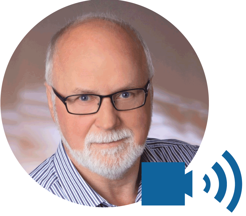 |
Wolfgang Niemeier
|
Potential of Space Based and Ground Based Radar Interferometry for Deformation Monitoring
Starting point will be a personal view on deformation monitoring, considering aspects of time and space domain for various emerging problems and a discussion on the potential of geodetic sensors and methods in the context of different disciplines.
Main emphasis of this presentation is radar technology for monitoring tasks. In a comprehensive way an introduction into modern concepts and methods of real and synthetic radar interferometry will be given, where equality and differences between space-based and ground-based sensors and concepts are worked out.
Then typical practical examples will be presented:
- Application of space-based InSAR for monitoring the displacements of buildings in inner cities during the tunnelling construction phase.
- Application of ground-based radar-interferometry for determination of slow-motion displacements of natural and artificial objects, like critical slopes or dams.
- Potential of ground-based radar-interferometry for monitoring of rapid displacements and even vibrations of structures, shown for towers and bridges.
A comparison of these methods and an outlook to position these methods within the complex field of monitoring methods will conclude this presentation.
Wolfgang Niemeier, Germany
Professor in Geodesy at Technische Universität Braunschweig – Institute of Technology, Department of Architecture, Civil Engineering and Environmental Sciences.
Study at TU Braunschweig and University Bonn, Dipl.-Ing. in Geodesy (1972). PhD at University Hannover(1987) with thesis: “Congruency analysis of multiple observed geodetic networks”. Habilitation at University Hannover in Geodesy (1987) with thesis: “On reliability aspects of geodetic systems”.
Lectures in “Engineering Surveying”, “Fundamentals of Geodesy for Civil and Environmental Engineers”, “Adjustment Theory and Applications”, “Deformation Analysis in Engineering Surveying”, “Documentation of Built Environment”, etc. Different stays as guest lecturer at University of Calgary (Canada), University of New South Wales (Australia), Technical University Vienna (Asutria) and Universidad Nacional (Costa Rica).
Research in Engineering surveying concepts and principles, Mathematical statistical methods for deformation analyses, Levelling and large area height determination, Automatic monitoring concepts, Terrestrial laser scanning, Space and ground based radar interferometry, Indoor navigation.
Member of German Geodetic Commission (DGK), Chair of FIG WG 6.1 Deformation studies, Member of different study groups of FIG and IAG, Editorial boards of Journal of Applied Geodesy.

